Collingwood's netwok of trails, cycling routes, and pathways support outdoor recreation, accessibility, and active transportation throughout the community.
On this page:
Collingwood Trails Network
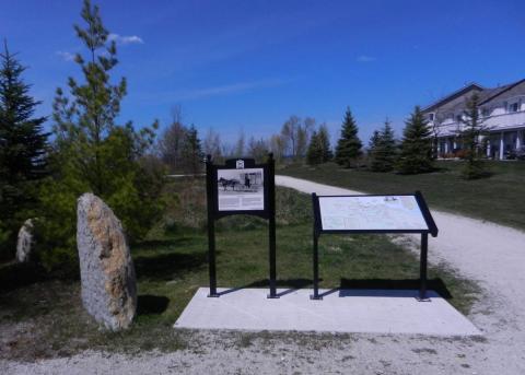
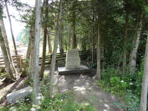
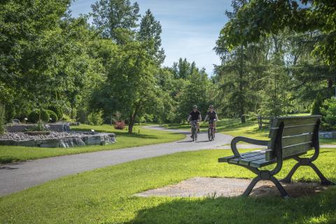
The Collingwood Trails Netwok includes more than 60 kilometres of multi-use recreational trails connecting parks, waterfront areas, and community destinations throughout the Town. The Trails Network offers recreational trails for cyclists, walkers, joggers, cross-country skiers, and snowshoers.
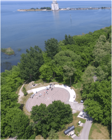
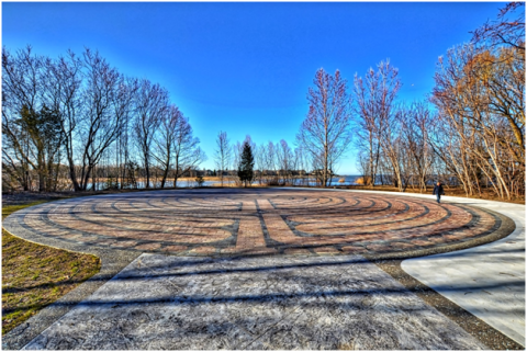
Major trail destinations include:
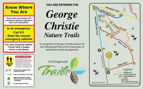
- The George Christie Nature Trails
- The shoreline of Sunset Point Park
- The scenic lookout at Millennium Park
- The tranquil gardens of the Arboretum
- The Collingwood Labyrinth
- The Museum and Historic Downtown Collingwood
The trail network includes granular, concrete, asphalt, wooden boardwalks, and natural surface trails. Most surfaced trails are flat terrain and generally accessible for people with physical challenges. Snowmobiles are permitted only on signed local access trails. No other motorized vehicles are permitted on the trails.
Outdoor activity supports both physical and mental well-being while helping residents and visitors stay connected throughout the community. In addition to its ever-expanding network of recreational trails, Collingwood is also expanding its cycling routes, bike parking stations and safe crosswalks to promote and encourage active transportation and alternative modes of travel in the area.
Water refill stations are available throughout the trail network from May to October to help trail users stay hydrated during wormer months.
Recommended Routes
Trail Etiquette
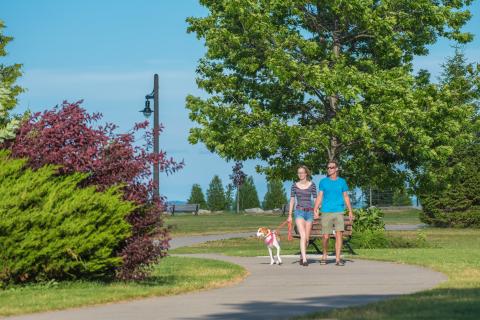
The Collingwood Trails are a multi-use accessible trail system for pedestrians, dog-walkers, cyclists, snowshoers, cross-country skiers, and snowmobiles on designated trails only.
To help provide a safe and enjoyable experience for all trail users, please follow basic etiquette items including:
- Pedestrians always have the right of way
- Stay to the right of the trail
- Pass on the left and sound a warning by bell or voice
- Do not block the trail
- Dogs must be on a leash and under your control
- Stoop and scoop after your pet and dispose of waste properly
- Keep music and personal entertainment devices at a respectful volume to hear others whom may be passing
Please do not leave pet waste or pet waste bags on the ground, as there are numerous pet waste bag dispensers located along the trails.
Safety on Trails
While many Collingwood trails are located near homes and businesss, some sections may become more isolated for trail users.
For your safety while using the trails:
- Travel with a buddy when possible
- Let someone know where you are ging and when you expect to return
- Carry a cell phone
- Stay aware of your surroundings
Emergencies can happen when you least expect them, so trail users are encouraged to plan ahead and use caution.
Active Transportation
Active transportation refers to human-powered travel such as walking, cycling, rollerblading, skateboarding, and mobility aids including wheelchairs and scooters.
Since 2015, Collingwood has continued expanding its active transportation infrastruture to include:
- On-road bicycle facilities
- Shared cycling facilities
- Multi-use pathways
- Bike parking stations
- Improved crosswalks and connections
These transportation options support:
- Healthier lifestyles
- Reduced emissions
- Energy savings
- Lower transportation costs
- A cleaner, healthier, and more livable community
E-Bikes
Collingwood's multi-use trails are shared by hikers, cyclists, dog walkers, runners, inline skaters, and other users. Please be courteous, share the trail, and cycle at a safe speed. Motorized vehicles are prohibited, except for personal mobility devices and permitted e-bikes.
Permitted E-bikes must:
- Be similar in appearance to a standard bicycle
- Include steering handlebars and pedals
- Provide motor assistance only while the rider is padaling
- Stop providing assistance when bike reaches 32 km/h
These bikes are commonly reffered to as:
- Pedalecs
- Pedal-assisted bikes
- Claass 1 E-bikes
If you would like to confirm whether a specific electric vehicle is permitted on local roads or trails, please contact Customer Service at 705-445-1030 or by email townhall@collingwood.ca
Volunteer Opportunities
Do you walk the trails regularly?
Do you want to help keep the trails clean, safe, and enjoyable for everyone?
Do you have a few extra minutes in a your weeks?
If you answered yes to any of these questions, consider joining our enthusiastic group of trail volunteers, including; Trail Captains, Map Distributors, Keen Photographers, and Community work parties.
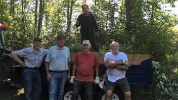
Trail Captains help care for a smal section of trail by removing litter and reporting hazards or maintenance concerns. Map Distributors help keep trail map boxes stocked throughout the network. We also welcome photographers to contribute trail photos and volunteers to assist with periodic trail improvement projects.
To learn more about volunteer opportunities, contact the Parks, Recreation and Culture Department by email at prc@collingwood.ca or phone 705-444-2500.